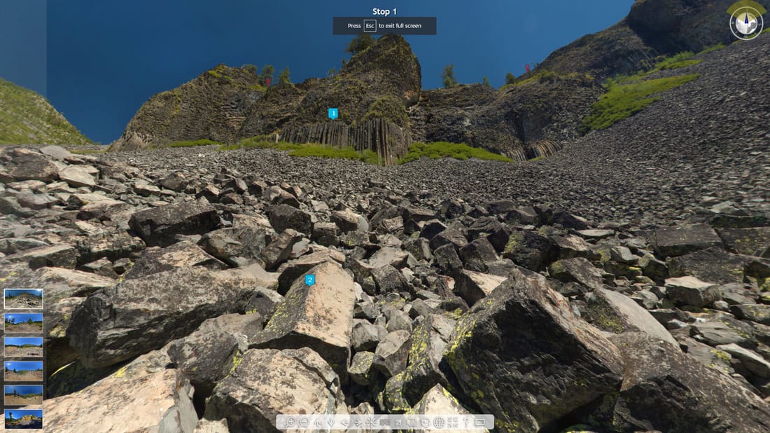
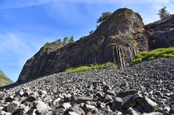
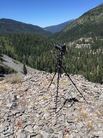
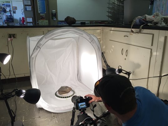
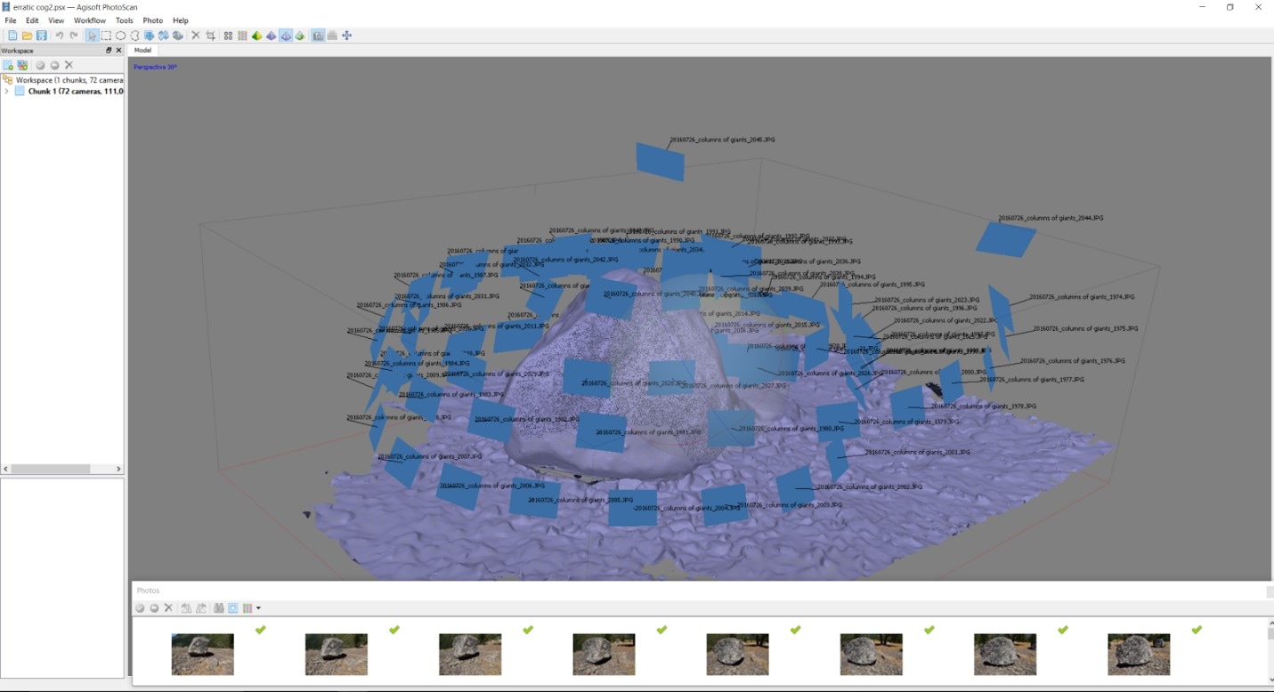
How a Unique Immersive Virtual Field Experience was Born.(This post was originally written for the January 2017 NAGT Eastern Section Bulletin) Twitter pays-off as a professional development tool. This is perhaps a quirky way to introduce my awesome experience with the inaugural cohort of the Science Friday Educator Collaborative, but in the past several years I have found no better tool than Twitter for geoscience inspiration and innovation in my classes at Turlock High School in California’s Great Central Valley. Beyond the many amazing tweets from scientists I follow, several tweets have come across my timeline which have changed the course of my teaching career. I read one such tweet from the National Public Radio (NPR) Show “Science Friday” in February 2016. The @SciFri tweet called for creative teachers to apply to their first annual Educator Collaborative with the stated goal of “participating in the collaborative development of new multimedia-driven education resources” inspired by the many amazing science-based articles and podcasts on ScienceFriday.com. The SciFri application asked for a hypothetical elevator pitch for an educational resource based on a list of pre-selected articles. The photojournal The Land of Volcanoes, Glaciers, and Mars-Like Deserts spoke to my photographic sensibilities as well as my desire to travel to Iceland. This was all the inspiration I needed to start kicking around ideas for a teaching resource. Near the time of the @SciFri tweet, several other tweets in my timeline were serendipitously planting the seeds of creation for what would become my immersive virtual field experience to the Columns of the Giants. Several tweets by Callan Bentley introduced me to the process of turning rocks into virtual 3D models using a computer-voodoo technique called photogrammetry. Ron Schott’s tweets, featuring his GigaPan photos of sites of geologic significance, continually awed me with their high-resolution zoomability and exquisite detail. With the Science Friday application kicking-around in my brain while reading about their techniques, I had a Eureka! moment. “Wouldn’t it be something” I thought to myself “if I could make a virtual geology field trip of Iceland that is comprised of high-resolution 360-degree photospheres, includes a virtual instructor and also has 3D rocks for students to manipulate?” It was a crazy and unrefined idea, and one I had very little knowledge of how to achieve. Nonetheless I impetuously pitched the idea to Science Friday. Somehow Science Friday education director Ariel Zych, and education assistant Xochitl Garcia bought the pitch and kicked-off an amazing 35-week project. So it Begins. Training Teachers to Make a Publishable Resource. Science Friday staff organized a wonderful series of Google Hangouts to facilitate the Collaborative participants’ understanding of what to expect as we worked with them. The broad vision of the Educator Collaborative was described, and project constraints were given. Collaborators were tasked with having to make a resource that was transmissible via the web and would cost a classroom teacher less than $20 per class to implement. Benchmarks and project deadlines were assigned and formal pitches had to be approved for development. Such an official process was very intimidating, but Ariel and Xochitl made the process stress-free with their great organization and encouragement. The series of induction classes made me quickly realize that I needed to actually learn how to make a high resolution photosphere, how create 3D models of rocks, and incorporate the new Next Generation Science Standards (NGSS) best-practices into the trip so that it would a valuable learning tool and not just a curiosity. I also had to find a California-based analogue to Iceland, since the land of fire and ice was hilariously outside of Science Friday’s budget. Several weeks were spent deliberating and scouting possible field trip sites with my wife, Laura, who is geologist and also happens to teach geoscience at the cross-town rival high school. The specific pedagogy to be used on the tour was left fluid until the site was decided and photos were made. A Brief Look at my IVFE Workflow. Drawing inspiration from the basaltic geology and glaciated landscapes of Iceland, I settled on creating a multi-stop virtual field experience at the Columns of the Giants in the Stanislaus National Forest, a mere 2.5hr drive from my home. The Columns of the Giants exhibit many geomorphologic similarities to the landscapes in Iceland. Towering walls of columnar-jointed basaltic trachyandesite rest atop glaciated granitic canyons. Perched on top of Columns’ wall are massive granitic erratics. It also has many wide-open views perfect for exploration in an IVFE. With my site chosen I then focused my attention on the tools needed to create a high-resolution IVFE. To make the photospheres I purchased the Nodal Ninja tripod head to which my NikonD750 could mount. I purchased AutoPano Giga to stich my photos and also bought its sibling software PanoTour Pro to create and export my virtual tours to the web. To create the 3D rock models I purchased Agisoft Photoscan software. I also purchased a pop-up photo tent and turntable to make the several hundred high quality images of rock specimens needed to generate the detailed 3D models. The base of the Columns of the Giants is easily accessible via a paved 800m long interpretive path, however accessing the top requires a three-mile mountain bike ride along an old logging road, and then another mile or so of bushwhacking and scrambling up talus slopes. {pic} I did this while carrying a 70-pound backpack filled with camera supplies, lunch and water. I chose six locations on the top of the Columns of the Giants due to their observable and significant geologic features. Twenty-four photos taken at various angles were needed to create each photosphere. Post-processing at home to generate the photospheres took nearly 100 hours of active engagement since I had to overcome a steep learning curve. The 3D models each took between 18 and 32 hours of computer processing time to generate but I was usually able to work on writing simultaneously. Throughout the entire process my wife was gracious enough to take care of our three year old son while I feverously pieced materials together.
Merging My Talents: Making the IVFE an Educational Tool. When I set out to create my project I wanted it to avoid becoming a gimmick with no teaching value. To make the project a viable resource for classroom use I created a Teacher and Student Tool Kit that guides students towards making evidence-based conclusions while in small group (groups of three) discussions. There are no “answers” given in my trip. Only clues and resources that are meant to enable a core tenant of NGSS: scientific discourse. To facilitate future small group discussions, students first need to spend time exploring and making discoveries while immersed in the unannotated version of the photospheres. The “blank slate” allows students to explore the site freely and to form their own observations. I suggest students create a several-page “field notebook” to sketch the intriguing areas that they find at each stop of the field trip. Students won’t be limited to observing near-field objects since the high-resolution photospheres allow for four-times zoomability. Students will also have the 3D models to “pick-up” and manipulate. Students should then share-out their sketches to their small groups so that they are exposed to various observations they very likely did not see. This can be done equally well with students that have a deep geology background or none at all. The second step of the IVFE is to give students background information on various geologic evidence they will see at each field trip stop. I created a short Geological Evidence Guide that allows students to reference pictures and short descriptions in a similar way that field guides are used in the field. The guides are best used after a preliminary read-through so that students will recall where to look in the future. The third step of the IVFE is to the guide students through several points of interest highlighted at each stop within the annotated version of the photospheres. The goal is for students to recreate the process that I would use to piece together the geologic story of a new field site. I intentionally left out explicit descriptions and instead created series of questions that I would ask myself at each area of interest. To answer the questions groups of students will need to collaborate with one another while referencing the Evidence Guide and Rock ID flow charts. I would suggest that students write their evidence-based answers and new sketches in their field notebook as they proceed through the experience. The trip concludes with two activities. The first activity asks students to construct a timeline of events at the Columns of the Giants using their gathered evidence. This activity would work well as a whole-group discussion centered around a large (3m) physical timeline stuck on a classroom wall. Students would add events (written on index cards) to the timeline and spend time re-arranging the events until the class comes to an evidence-based consensus. The goal isn’t necessarily a “correct” timeline, rather it is that a conclusion can be made made based on evidence cited during class discourse. The second activity asks students to analyze a variety of photos from around the world and to hypothesize about how each landscape was formed based on the features they learned to identify during the IVFE. Learning to Edit Perhaps the most educational aspect of my Science Friday Educator Collaborative experience was learning of the existence of commenting and editing tools on Microsoft Word. My copy text went through at least fifteen rounds of editing with folks who edit for a living. I am by no means a strong writer, so it was a relief to have the professionals of Science Friday work so patiently with me to craft an amazing result. The Moment of Truth: Release Date & a Conversation with Ira Flatow. The Science Friday Staff worked hard to move-up the release date of my resource when they learned that that I would be attending the 2016 AGU conference. We all wanted to informally share the resource at the Geophysical Information For Teachers workshop that was feature speakers from Google Expeditions and also the VR content creators for the Critical Zone Observatories. Ariel and Xochitl used their colleagues as beta-testers for my IVFE and their responses were very constructive and enthusiastic. Ira Flatow, the host of Science Friday was thoroughly amused by the project and thus I found myself invited to be on the actual Science Friday radio show on December 12th, 2016. The prospect of talking to over one million listeners was a bit overwhelming, but my desire to share the resource heavily outweighed my trepidation. I spent several days trying to figure out how to best convey my visual resource using only speech, but Ira’s enthusiastic and specific questioning made it easy to describe. I still haven’t listened to the entire interview but my wife and my mom gave it enthusiastic reviews. Opportunities Abound The Science Friday Educator Collaborative allowed me to create a dream resource for my classes. The wide distribution of Science Friday has allowed my teaching skill set to be seen and appreciated by millions of people. It also made me locally “famous” for a few days when I was featured in the local newspaper. The feather in my cap was making the Science Friday Best of 2016 list and having assistant producer Katie Hiler say this: “While all the resources from the inaugural class of educator collaborators have been fantastic, this virtual field trip experience is one of the most innovative and cutting-edge pieces of content I’ve seen from not just Science Friday, but all of public radio this year.” Such recognition is not needed for me to do passionately do my job, but it sure feels nice when it happens. And to think, this was all made possible by a few Tweets. The Columns of the Giants Immersive Virtual Field Experience.
3 Comments
3/6/2017 09:07:53 am
Wow, what great work! This is just the sort of content that's missing from educational VR. Awesome job!
Reply
Ryan J Hollister
3/6/2017 04:05:38 pm
Thanks!
Reply
Leave a Reply. |
Archives
June 2024
AuthorRyan J Hollister - Geoscience & EnviroSci Educator, Avid hiker, Landscape photographer, WildLink Club Advisor, Central Valley Advocate. |
 RSS Feed